Saturday, June 30, 2012

Roma Aeterna

With the recent feast days that we have celebrating, and are celebrating today, it seems fitting to ponder for a moment, the "Eternal City" of Rome.

Founded in 753BC by Romulus on the Palatine Hill, Rome sits on the Tiber River in the region of Lazio, formerly Latium.  The city quickly spread to the Seven Hill near the Palatine.  It was this area that was enclosed by the Servian Wall in 565BC.  This was Rome of the kings and of the Republic.

Imperial Rome expanded beyond the Servian Wall and the Seven Hills both west of the Capitoline Hill in the flat ground that had been the parade ground of the city -- the Campus Martius, now Campo Marzio -- next to the Tiber, and across the Tiber into Trastevere.  In 270AD, the Aurelian Wall was constructed to enclose those new sections of the city.  The Vatican Hill across the Tiber, site of the martyrdom of St. Peter in 64AD, remained fuori le mura, outside the walls.  Indeed, it was outside the walls, as per Roman law, that the burial ground of the catacombs are to be found.


File:Roma Plan.jpg
Map of Imperial Rome -- the red area marks the sections of the city inside the Servian Wall (Rome of the Republic) on the Seven Hills, while the light pick includes those areas inside the Imperial Aurelian Wall.

After the fall of the Western Roman Empire, Rome became a bit of a backwater, saved from oblivion only by the presence of the Popes.  With the disruption of the Empire, the population center of the city shifted from the drier Seven Hills into the moist ground of the Campo Marzio.  This section of the city became densely populated during the Medieval period, and the eastern sections of the city, near the Lateran and forum, became almost park-like in their lack of population.  In 852AD, Pope St. Leo IV oversaw the construction of the Leonine Wall that finally brought the Vatican and the Borgo neighborhood into the city.

File:1652 Merian Panoramic View or Map of Rome, Italy - Geographicus - Roma-merian-1642.jpg
Baroque Rome (1642AD).  Notice the Vatican at the bottom left corner, within the walls, the densely packed Campo Marzio in the bend of the river, and the park-like look of the eastern portions of the city, at the top of this painting.

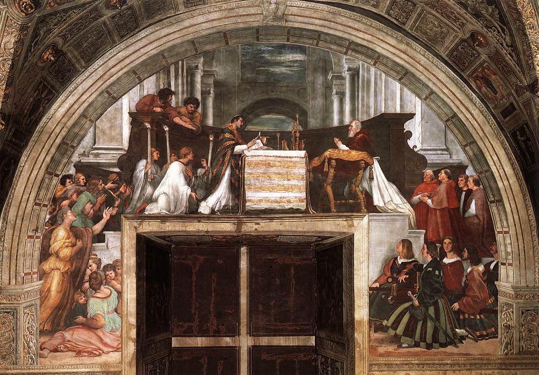
The Popes of the Renaissance and Baroque eras did much to revitalize Rome, with Julius II beginning work on a new St. Peter's Basilica at the Vatican in 1506AD, and Pope Sixtus V clearing wide avenues and erecting oblisks around 1585AD.  Few men have done as much to beautify the city was Gian Lorenzo Bernini (+1680), who built the canopy and colonnade at St. Peter's, designed the Piazza Navonna, and enriched many of the Churches of the city with his genius.


The view of St. Peter's Basilica from the Ponte Sant'Angelo.  Of course, this would be looking from the edge of the old Campo Marzio out of the Imperial City.

Here is a brief video of walking about parts of Eternal City:


We shall have to come back and visit some of the great sites and basilicas in the coming days...

Live well!

Wednesday, June 27, 2012

Seven Days - Gaine's Mill

The second major battle, and the third day, of the Seven Days Battles of 1862, 150 years ago, fought on 27 June 1862, was that of Gaine's Mill.

File:Gaines's Mill 1900.png
The map shows the coordinated attacks of the Confederate forces towards the end of the battle.

Here, the V Corps of the US Army of the Potomac that had beaten off Lee's attacks at Mechanicsville or Beaverdam Creek, were pummeled once more.  Despite their strong defensive line on the high ground above Boatswain's Swamp, the Union forces could not withstand the coordinated attacks that came during the evening of the Battle of Gaine's Mill.  The result: the Union army would abandon its positions north of the Chickahominy River, abandon their supply line back to West Point, retreat to the James River to the south, and, in the end, abandon their offensive against the capital of the Confederacy.  This battle, though Confederate casualties outnumbered Union 8,700 to 6,800, saved Richmond for the South.  Though the Seven Days Battles would rage for several more days, US Major General George B. McClellan was beaten, and his massive Army of the Potomac had given up.  Richmond and the Confederate State of America were back from the brink of defeat.

Here is the NPS description of the Battle, in brief:
http://www.cr.nps.gov/hps/abpp/battles/va017.htm

Live well!

Tuesday, June 26, 2012

Seven Days' Battles - Mechanicsville

Today in 1862, Robert E. Lee's Confederate Army of Northern Virginia launched an aggressive attack on George B. McClellan's Union Army of the Potomac at Mechanicsville, Virginia, in Hanover County.  This attack across the Beaverdam Creek opened a series of assaults known to history as the Seven Days Battles.  Although this was techincally the second of the "Seven Days," it marked the first major battle.

The situation was this: ever since the Battle of Seven Pines, or Fair Oaks, at the end of June, the Union Army of the Potomac, even though it outnumbered the Confederate force sitting between it and the Southern capital of Richmond, Virginia, sat idle.  The dramatic ride around the Union army by J.E.B. Stuart and his Southern troopers in the middle of June revealed the particular dispositions of this hostile host to the new commander of the Confederate army, Robert E. Lee.  He realized that General McClellan had only left a single corps, the V Corps, north of the Chickahominy River -- not only meaning that this corps was isolated, but meaning that but a single corps protected the Union supply line back to West Point, Virginia.  Lee recognized an opportunity here, even if his Southern force was outnumbered.  If the Confederate massed their forces and destroyed the isolated V Corps, McClellan and the rest of the Army of the Potomac would be cut off from their supply line, and would have little choice but to fall back from the gates of Richmond.

Lee, with a reputation for being timid, would quickly convince both friend and foe of his aggressive streak with the attacks that would follow during the Seven Days.  To add to the numbers of the Army of Northern Virginia, Lee also directed Stonewall Jackson's victorious Valley Army to join his force for the fighting that was to come to the Richmond front.

In launching an attack on the V Corps north of the Chickahominy, Lee took a great risk, as he left only 25,000 men defending lines directly in front of Richmond south of that river, in the face of the bulk of McClellan's 100,000 man force.  Lee counted on McClellan having ceded the initiative.  He was right.

On 26 June 1862, the Seven Days Battles began with the attack on the Union V Corps of US General Fitz John Porter at Mechanicsville, positioned on a ridge overlooking the Beaverdam Creek.  If the gentle reader ever gets the chance to visit this field of battle, it is memorable, indeed, and is today a part of the Richmond National Battlefield Park.  The ground very much favored the Union defenders, but Lee planned for Jackson's Valley force to arrive beyond the right flank of the Yankee host -- a right flank with J.E.B. Stuart found to be devoid of a cavalry screen.  Tragically, for the attacking forces of the division of A. P. Hill, Jackson's men did not arrive in time, and Confederate losses along the Beaverdam Creek at Mechanicville were heavy, indeed.  The casualty count was 400 US to 1,300 CS lost.  It was one of the least impressive moments in the career of Stonewall Jackson.


Beaver Dam Creek north of Rt 156
Can you imagine crossing this creek under fire to storm the right on the right?  That was the task of the division of CS General A. P. Hill at the Battle of Mechanicsville or Beaverdam Creek, 26 June 1862.

Confederate Attack at Beaver Dam Creek Photo, Click for full size
This map, from a sign at the battlefield, shows the particular dispositions of the battle.

This link provides an account of the fighting at Mechanicsville, or Beaverdam Creek, as presented by the National Park Service:
http://www.cr.nps.gov/hps/abpp/battles/va016.htm


File:Seven Days June 26-27.png
Map showing the actions at Mechanicsville on 26 June and Gaine's Mill on 27 June.

Despite the heavy loses for the Southern forces, the V Corps fell back to a new defensive position at Gaine's Mill near Cold Harbor, Virginia.  Here, the next day, another Confederate attack would pummel and finally overwhelm the V Corps.

For the reader that might like to read about the modern sites of these battles, the site of the Richmond National Battlefield Park is most helpful:
http://www.nps.gov/rich/index.htm

Live well!

Monday, June 25, 2012

Historical Marker Database

Brent Town Marker Photo, Click for full size


If the reader is anything like this writer, he very much enjoys roadside historical markers, but often finds it difficult to stop and read them.

That being the case, I was rather please to find The Historical Marker Database: http://www.hmdb.org/

This website allows you to not only look up and read signs that you have seen passing by on your local highway, but also to find new signs or markers on topics that you might be interested in.

I have used it with great success to find markers for particular campaigns or events that I had no idea even existed.  Likewise, it is a great way to verify what you will find, even if you already know the sign is there.

So, I close with a link to my local marker, for the Signal Hill:
http://www.hmdb.org/marker.asp?marker=28376

Signal Hill Marker Photo, Click for full size

Live well!

Friday, June 22, 2012

The Breaks

While we are pondering what lies in the mountains along the modern Virginia-Kentuky state line, we certainly ought not omit mention of the deepest gorge east of the Mississippi River: the Breaks.  This gorge is formed by the Russell Fork "breaking" its way through Pine Mountain.  The resulting canyon is called by some "The Grand Canyon of the South."  While quite beautiful, this natural site is, of course, simply not on the scale of such gorges in the western United States.  Still, it is well worth a visit if you are in the area!

File:Breaks.jpg
A view of the Breaks from Dickenson County, Virginia.

It is said that the famous Daniel Boone discovered this gap, or break, in Pine Mountain in 1767AD.  This was, and is, the only such gap in the mountain for a stretch of 125 miles.  Its remote location and narrow sides meant, however, that it never hosted the traffic that Cumberland Gap to the south would.

Today the Breaks are part of "Breaks Interstate Park" that is so-called owing to its being in both the Commonwealth of Virginia and of Kentucky.  Here is the web-site for this part:
http://www.breakspark.com/


Live well!

Thursday, June 21, 2012

Cumberland Gap

Few mountain passes in the Appalachian Mountains of the Eastern United States are as well known and historically significant than Cumberland Gap that sits on the Virginia-Kentucky state line (and just north of Tennessee, too).  This mountain gap was named for the unfortunate character, Prince William, Duke of Cumberland (1721-1765), son of King George II and victor over Bonnie Prince Charlies at the 1746AD Battle of Culloden.  Two counties in Virginia alone are also named for him: Prince William County, while he was but a boy in 1731AD, and Cumberland County in 1749AD, after his victory at Culloden.

File:Cumberland Gap.jpg
Cumberland Gap.

This Gap, which is a low point in the Cumberland Mountain of the Appalachians, was once the gateway to the Ohio Valley and what is now Kentucky.  Indeed, Daniel Boone cut his Wilderness Road through this Gap in the mountains.  He was hired to clear this path to open up the settlement of Kentucky in 1775AD.

The next year, 1776AD, the Virginia Assembly formed "Kentucky County" to administor these newly settled lands.  That rather massive Virginia county would be split into three counties (Fayette, Jefferson, and Lincoln) in 1780, follwed by six other new counties before the whole area acheived statehood as Kentucky in 1792AD.  Just so you know, one of those six others, Bourbon County, formed in 1785, was named for the French Royal family that assisted the cause of American Independence, and gave its name to the famous corn-based whiskey that is one of the glories of the Commonwealth of Kentucky.


File:Wilderness road en.png
A Map of the Wilderness Road and the 18th century frontier of Virginia (Recall that Kentucky remained a part of Virginia until its statehood in 1792)  Cumberland Gap marks the point where the Wilderness Road enters the Appalachian Plateau.

The Cumberland Gap proved a point of strategic interest during the American Civil War, as well, changing hands several times.

While formerly used for US Highway traffic, a tunnel has now been constructed allowing the Cumberland Gap to rest as a historic park.

Today the Gap sits at the heart of a National Park Service installation: Cumberland Gap National Historical Park:
http://www.nps.gov/cuga/index.htm


This National Park Service map affords an excellent idea of what is at the Gap today:
http://www.nps.gov/cuga/planyourvisit/upload/CUGAmap2.pdf


Live well!

Tuesday, June 19, 2012

Sheriff in Colonial Virginia

The office of Sheriff is a rather ancient one, indeed.  In the colony and dominion of Virginia, prior to its independence, it looked and operated a bit differently then we might be accustomed to in our day and age.  Much of this colonial office remained unchanged by the Revolution, so the following description is also apt for the early days of the Commonwealth.

File:UK Coat of Arms Governor's Palace.jpg
The Coat of Arms of the Kings of Great Britain of the House of Hanover -- on a building in Williamsburg, VA.

The following is an account of the office of Sheriff in Cumberland County, in the Piedmont of Virginia, during the 18th century:

The office of sheriff was a “fee officer” position, as the sheriff received payments for the duties he performed.[1]  Nevertheless, a “salary” of one thousand pounds of tobacco was allotted to cover any other expenses.  The governor appointed the sheriff, upon the commendation of the county court, to serve for not more than two years.  Typically, the court submitted the names of three men – all of whom had to be presently sitting on the court: “no one but a justice could be sheriff.”[2] Thus, the 17 October 1770 excerpt from the Executive Journals of the Council shows:

John Mayo, William Smith, & Richard James, Gentn. Having been recommended by the Court of Cumberland County, as Persons proper for the Office of Sheriff of that County for the ensuing Year, & divers Certificates being produced of the said John Mayo’s having declared he would not accept of the said Office;
Ordered, that a Commission immediately issue, appointing the said William Smith Sheriff of the said County.[3]

Once appointed sheriff of the county, membership in the House of Burgesses [the colonial assembly and forerunner of the House of Delegates] was forbidden.  Indeed, in 1769 “this prohibition was extended to two years after the sheriff completed his term.”[4]  Hence, when George Carrington was named sheriff of Cumberland County in 1764, he relinquished his seat in the House to Thomas Prosser.  This was one instance were the possession of multiple offices was not deemed acceptable.

The sheriff of Cumberland, as any colonial Virginia county, was responsible for numerous and varied duties.  In addition to law enforcement, the sheriff was responsible for the upkeep of the jail and any prisoners,[5] the collection of taxes,[6] the overseeing of elections for the House of Burgesses,[7] and generally being the “chief executive officer of the county,” which included a great deal of other “miscellaneous administration.”[8]  Needless to say, this kind of authority, particularly regarding collecting of taxes and fees and the managing of elections, was prone to abuse.  Hence, the Assembly in Williamsburg constantly passed laws to remedy “the problem child of the period.”[9]  Indeed, a “bond of 1000 £ sterling…to insure” that the sheriff “shall collect and account for Cumberland rents and dues, and all other matters relating to his office” was demanded!  This was required of the first sheriff of Cumberland, Stephen Bedford, and he, along with Alexander Trent and Archibald Cary, paid the bond on 22 May 1749.[10]  Particularly challenging was the accurate listing of tithables and collecting of the taxes.  The fact that the sheriff received a commission on the taxes that he collected was problematic.  Lieutenant Governor Francis Fauquier, in his account of the quitrents paid for the year 1765, notes that Cumberland County paid some £295, 18 shillings, and 6 pence for 295,923 acres of land.  The allowance granted to the sheriff for the collection of this amount was £29.11.10.[11]  Cumberland seemed to have little habit of paying the quitrent in arrears.  Much like the county court, the sheriff was primarily concerned with maintaining the common good and order of the county; viz., with keeping the king’s peace.


[1] Porter, County Government in Virginia, 28.  In Porter, 73, a schedule of fees as of 1732 for a Virginia sheriff is given.  It includes the following: “Making an arrest…30, Serving an order of the court…15, Use of the stocks…10, Keeping a prisoner, per day…5, Calling a court…200.”  Cf. IV Hening 348.
[2] Ibid., 69.
[3] Executive Journals of the Council of Colonial Virginia, Vol. VI, 1754-1775, 369.
[4] Porter, County Government in Virginia, 71.
[5] Ibid., 30.
[6] Ibid., 74.
[7] Kolp, Gentlemen and Freeholders, 32-35.
[8] Porter, County Government in Virginia, 74.
[9] Ibid., 68.
[10] Cumberland County, Virginia deeds, 1749-1752 (Miami Beach, FL: TLC Genealogy, 1990), 3.
[11] George Reese, ed., The Official Papers of Francis Fauquier, Lieutenant Governor of Virginia, Vol. III (Charlottesville: The University Press of Virginia, 1980), 1417.  Lest the reader be confused, the currency of the day was either in pounds sterling, or pounds tobacco.  If pounds sterling, 1 pound, or £1, was equal to 20 shillings, and 1 shilling was equal to 12 pence.  Thus, £29.11.10 is the shorthand way of writing twenty-nine pounds, eleven shillings, and ten pence.  For what its worth, the penny was divided into four farthings.
[From,"To declare for an Independency": Cumberland County, Virginia and the Revolution: 1749-1789 / by Thomas Eric Cole; http://magik.gmu.edu/cgi-bin/Pwebrecon.cgi?BBID=1427221]

Live well!

Monday, June 18, 2012

WAR!! In 1812...

Today is the Bicentennial of the start of the War of 1812.  On this day, 18 June 1812, President James Madison signed the declaration of war passed by both the House (79-49) and Senate (19-13) earlier in the month.

File:USS Constitution vs Guerriere.jpg
USS Constitution v. HMS Guerriere by Michel Felice Corne (+1845AD)

So begins the first declared war of the United States of America.  Some characterize this conflict as a sort of "Second American Revolution" in which the newly independent USA defended their sovereignty from a British attempt to retake the country.  The writer of this blog would disagree with this assessment -- the primary war aim of the United Kingdom was simply to maintain control of Canada.   This they did, even while having to wrap up the conflict with Napoleon.  There is certainly more to say as the anniversaries of events come and go.  A little background, then, on the declaration of war that today's anniversary marks:

The U.S. was drifting into the Napoleonic conflict toward the end of the Presidency of Thomas Jefferson.  From 1789 to 1805 US shipping increased from 100,000 to a million tons – supplying both Britain and France.  Then, in 1807, the British Parliament passed the “Orders in Council," which forbid US trade with the enemy of Britain: Napoleonic France.  France had issued similar orders, the Continental System of 1806, but, of course, could not enforce them the way the Royal Navy could.

In 1807 Congress and President Jefferson adopted the Embargo Act as the reply – no US foreign trade.  The replacement of President Jefferson with newly elected James Madison in 1809 didn't eliminate the problem.  In 1809 the US replaced the Embargo Act of 1807 with the Non-Intercourse Act, which forbid trade with France and Britain, but opened up to other nations.  This would expire in 1810.  Madison decided to deal with the whole matter by stating that as soon as one of the two powers lifted restrictions with the US, we would cease trading with the other.  Napoleon acted first, in 1810, lifting statutory restrictions while continuing to harass American shipping.  Britain even followed suit, on 16 June 1812, but the United States declared war on 18 June.  Free trade rights were not the only cause of the war – impressment of American citizens, hopes to expand (Canada & Florida), and Indian troubles blamed on Britain all fed the war fever.

We shall have to keep track of this war as it develops.

Live well!

Sunday, June 17, 2012

St. Botulph & Boston

Today is the feast day of St. Botulph or Botolph, a 7th Century Anglo-Saxon Abbot that few have ever heard much about.  His connection to Boston, however, means that his name is not altogether forgotten!


St. Botulph was the first abbot in Lincolnshire and was a man of great holiness of life, who died in 655AD.  Here is a bit more about this obscure saint:
http://saints.sqpn.com/saint-botulph-of-ikanhoe/


A town was named for him in Lincolnshire, England, orginally called Botulph's Town, then Botulphstown, which became, simply, Boston.  Thus, Boston, Massachusetts is at least indirectly named for a 7th century abbot.

While you are pondering Boston, MA, perhaps you might take a look at the old State House that was the heart of colonial Boston:
http://www.bostonhistory.org/?s=osh

File:Old State House Boston Massachusetts2.jpg


Live well!

Saturday, June 16, 2012

Drought Monitor

Droughts are a constant source of hardship and worry, and have been throughout human history.  While most in the developed world are not directly involved in food production, the impact of drought still impacts the prices of what we buy, and the availabilty of water for other uses.


There are several excellent sites on the internet that track drought conditions in various locations.


The Drought Monitor webpage is a great resource for those in the United States who would like to keep tabs on what parts of the country are a bit dry, or experiencing a severe drought.  This site is updated weekly:
http://droughtmonitor.unl.edu/


There is also a North American drought monitor site that extends the data to Canada and Mexico:
http://www.ncdc.noaa.gov/temp-and-precip/drought/nadm/


Finally, this site monitors conditions world-wide, updated monthly:
drought.mssl.ucl.ac.uk


Dry Dirt in the Sonoran Desert.

Live well!

Thursday, June 14, 2012

Music of the Electoral Palatinate

Few but music historians have spent much time thinking about the music that came out of the German Electoral Palatinate -- the home of the Count Palatine of the Rhine, and Elector of the Holy Roman Empire.  This area, called the Kurpfalz or Pfalzgrafschaft bei Rhein in German, actually has a musical school all its own, named for the city that was its capital after 1720AD: Mannheim.

File:Map of the Oberämter of the Electoral Palatinate (1789) - Numbered.svgFile:Arms of the Palatinate (Bavaria-Palatinate).svg
A map of the Electoral Palatinate (Mannheim is #2) along the Rhine River and its coat of arms. If the shield reminds you of that of Bavaria, that is well, for the Kurpfalz was traditionally ruled by a branch of the same Wittelsbach family that ruled Bavaria.

For this post, I will highlight four composers from this German state.  We start with Johann Stamitz (+1757), father of a couple of other composers, and a rather influential member of this musical school.  This is the first movement of an orchestral trio in C minor, Opus 4, N. 3.


Now, from his son Karl Stamitz (+1801), a Concerto in D major that gives a good example of the "Mannheim Rocket," I think, which is the bold and immediate "rocketing" into the theme of the work.


Next, Christian Cannabich (+1798), a personal favorite of mine, and a man renowned in his time for his ability as a conductor, as well.  Here is his Symphony No. 63 in D major -- though I do prefer his minor key works.  The fellow pictured is Charles Theodore, Elector Palatine and Duke of Bavaria (+1799), Cannabich's patron:


Finally, Franz Xaver Richter (+1789), and Symphony No. 59 in B Flat Major to round out the group:


Live well!

Wednesday, June 13, 2012

Roadside Weeds

Throughout much of the world, the same species of plant seem to proliferate along the roadside and abandoned lot -- they are typically passed off as "roadside weeds."

Now, while not always glamorous, a number of these species are intriguing, some of which are even beautiful, if not for their habits.  There can be something rather enjoyable about trying to figure out what manner of flowers line a highway, and a certain delight in seeing a familiar bloom, even if a humble one.

For those in Virginia, Virginia Tech has a page that gives a good run down of "weed" species:
http://turfweeds.contentsrvr.net/category_browse.vesh

I wanted to highlight a few, eight in all, particular species that I often see, and most appreciate.


I begin with Chicory (Cichorium intybus), for who is not familiar with the blue roadside bloom of the lanky Chicory.  They are also interesting in being a coffee substitute.
Cf., http://turfweeds.contentsrvr.net/category_detail.pg_61.vesh


File:Asclepias syriaca.jpg
Next, the Common Milkweed (Asclepias syriaca), a rather distintive plant if ever there was one.  The pinkish ball-shaped flower bundle, the round-wide leaves, and the rather milk sap.  The Milkweed is also interesting for the several species of insect that rely exclusively on this plant for food and shelter.  These include the Monarch Butterfly (Danaus plexippus), the Milkweed Beetle (Tetraopes tetraophtalmus), Large Milkweed Bug (Oncopeltus fasciatus).
Cf., http://turfweeds.contentsrvr.net/category_detail.pg_88.vesh


File:Linaria vulgaris.jpg
Recently, my wife located a delightful little weed called either Butter-and-Eggs or Yellow Toadflax (Linaria vulgaris).  This one falls into the category of what is certainly a weed, but a surprisingly attractive one, nonetheless.
Cf., http://turfweeds.contentsrvr.net/category_detail.pg_301.vesh


File:Starr 040723-0030 Verbascum thapsus.jpg
Surely most of my readers have, from time to time, noticed the fuzzy biannual, the Common Mullein (Verbascum thapsus).  Its first year, it remains a flat whorl of fuzzy grey-green leaves.  Its second year, however, it sends up a tall stalk bearing yellow flowers.
Cf., http://turfweeds.contentsrvr.net/category_detail.pg_120.vesh


File:Solanum carolinense in flower.jpg
This little weed certainly fits the description of rugged -- the Horse Nettle (Solanum carolinense).  A member of the Nightshade family bearing spines, it is certainly noxious, though its little flower is endearing!
Cf., http://turfweeds.contentsrvr.net/category_detail.pg_282.vesh


File:Plantago lanceolata P6200323 箆大葉子、ヘラオオバコ.jpg
For simply being ubiquitous, I must include the English or Buckthorn Plantain (Plantago lanceolata).  There is not much to say about this species, except that perhaps everyone on Earth has seen one.  That, I suppose is an accomplishment in itself!
Cf., http://turfweeds.contentsrvr.net/category_detail.pg_283.vesh


File:Taraxacum officinale - Köhler–s Medizinal-Pflanzen-135.jpg
Also in the ubiquitous category, but the favorite of little children who love to scatter their seeds, and of wild food enthusiasts who eat them, is the Dandelion (Taraxacum officinale).
Cf., http://turfweeds.contentsrvr.net/category_detail.pg_2.vesh


File:Melilotus alba bgiu.jpg
I conclude this entry with the species that dominates the highway near my home right now: White Sweet Clover (Melilotus albus).  It is not the same as the short and familiar White Clover (Trifolium repens) and Red Clover (Trifolium pratense) of your lawn; this is a lanky, tall, speciman of roadsides.
Cf., http://turfweeds.contentsrvr.net/category_detail.pg_268.vesh

Live well!

Tuesday, June 12, 2012

150th of J.E.B. Stuart's ride

Today, in 1862, Confederate General James Ewell Brown ("J.E.B.") Stuart, departed with 1,200 troopers to ride around the Union Army of the Potomac.  He was sent by the commander of the Confederate Army of Northern Virginia, Robert E. Lee, to reconnoiter the Union positions.  Indeed, since the Battle of Seven Pines, the two armies sat literally staring each other at the outskirts of Richmond, the capital of both Virginia and the Southern Confederacy.  Lee was ready to take the initiative and drive US General McClellan back.  To do that, he needed to know what sat before him.

File:Jeb stuart.jpg
CS General J.E.B. Stuart.


Stuart rode out on 12 June 1862, and with his men rode 22 miles north of Richmond, Virginia, before they turned east around the Union host.  While there may have been thought of returning to the Confederate lines directly from whence they came, at Hanover, pursuing Union troops convinced Stuart to simply ride around McClellan's army.

It was a thrilling raid and ride that involved scraps with Union troops, demolishing bridges, and looting supply depots.  Stuart and his troopers would ride safely into Lee's headquarters the morning of 15 June 1862, having ridden 150 miles and gone completely around the Union Army of the Potomac, with its 100,000+ men.

stuartsmap.jpg (83764 bytes)

This site has a good account of the ride:
http://www.civilwarhome.com/stuartsride.htm

This ride secured the name of J.E.B. Stuart amongst the list of great horseman, gave Lee the intelligence he needed for the coming offensive, and further demoralized a Union force that had given up the initiative in this Peninsula Campaign.

We shall return to the outskirts of Richmond, Virginia at the end of the month for Lee's attack -- the Seven Days' Battles.

Live well!

Monday, June 11, 2012

Music of the Venetian Republic

As a sort of continuation of what I began in the New World, I will take a little journey around the Old in the coming weeks and note some of the achievements of its great musical centers.  The reader will forgive me if I favor the Classical and Baroque eras...

In its Baroque peak, the little Republic of Venice, the Most Serene Republic, seemed to produce a disproportionate number of excellent musical composers.  I will give samples of four of them here.

File:Venezianische Kolonien.png
A nifty map should the extent of the Serenissima Repubblica di Venezia at various times.

Giovanni Gabrieli (+1612AD), his In Ecclesiis.  The Church interior shots are from the famous Basilica of San Marco.  Gabrieli makes good use of the organ, and certainly likes a big sound from his choir!


Claudio Monteverdi (+1643AD), his motet Beatus Vir, after the Psalm.  He is also rightly famous for his Operas, and his 1610AD setting of the Vespers of the Blessed Virgin.


Tomaso Albinoni (+1751), his Concerto Op. 9/2 in d minor, first movement.  Not bad for one whose actual trade was that of a printer.  Of course, Albinoni is most famous for his Adagios, but we ought not neglect the other parts of his delightful Concerti!


Lastly, the most famous, the "red priest," Antonio Vivaldi (+1741AD), from his "La Stravaganza," Concerto No. 1. 


Just to round things out with one of Vivaldi's religious works, we have a setting of the Gloria, RV 589.


Live well!

Saturday, June 9, 2012

Tea

Having earlier noted a bit about the great drink of coffee, today I pay my dues to tea.

Tea is certainly one of the most popular drinks in the world, a fierce rival to coffee, and actually more popular in many regions.  The drink is derived from the cured leaf of the Tea plant (Camellia sinensis), a member of the family Theaceae.

File:Camellia sinensis - Köhler–s Medizinal-Pflanzen-025.jpg
Diagram of Camellia sinensis.

It is an evergreen plant that grows in tropical or subtropical regions.  You can see in the map below the main countries of production.  Obviously, China and India dominate much of the market, though I am partial to some of what I have had from Sri Lanka (Ceylon).

File:WorldTeaProductionFAO2008.svg
Tea Production by Country -- the darker the green, the greater the production.

The different kinds of tea are derived from the different manners of processing, rather than different species.  This chart gives you an idea of where we get Green, Black, Oolong, White, and Yellow Teas from:
 
Chart of Tea Processing Steps for different kinds of tea -- note that Black Tea is red, and Green Tea is green!

To see this extremely useful chart in higher resolution, follow this link: http://upload.wikimedia.org/wikipedia/commons/1/13/Teaprocessing.svg

Of course, many teas involve blends, such as Earl Grey Tea, which is a black tea that also has the oil of bergamot, derived from the rind of the Bergamot Orange (Citrus bergamia) added to it.

This video gives you an idea of the production of tea, as seen in West Bengal and Assam, India:


Time for a cup of tea...

Live well!

Friday, June 8, 2012

150th of Cross Keys and Port Republic

After nearly finding himself trapped in the lower Shenandoah Valley next to Winchester by the arrival of Fremont's Union Mountain army coming from what is now West Virginia and elements of McDowell's Union Rappahannock force coming from the area of Fredericksburg, Virginia, Stonewall Jackson now fought those forces on the 8th and 9th of June 1862 near Harrisonburg, Virginia.

File:Jackson's Valley Campaign May 21 - June 9, 1862.png
The Shenandoah Valley Campaign from the Battle of Front Royal to Jackson's departure for the Peninsula; notice Cross Keys and Port Republic at the bottom left of the map.

These two battles were the Battle of Cross Keys against Fremont on 8 June 1862, and the Battle of Port Republic on 9 June 1862 against a detachment of McDowell's under James Shields.

CS Major General Thomas "Stonewall" Jackson had already managed to drive US Gen Banks and his force out of the Valley with the great victory at Winchester.  Jackson also evaded the trap that sought to close off his route back up the Valley at Front Royal -- now Jackson had to blunt those forces that now pursued him.  That is precisely what he would do at these two battles.

At the Battle of Cross Keys, 8 June 1862, in Rockingham County, Virginia, the Confederates under Jackson's subordinate, Richard Ewell, though outnumbered 2 to 1, were able to halt John C. Fremont's attacks, conduct an effecient withdrawal, and burn the bridge over the North River.  This allowed Jackson's whole force to face Shields the next day at Port Republic, and Fremont could only listen.

File:Battle of Cross Keys map.png
Map of the Action at Cross Keys, Va.

Here is the NPS account of the battle: http://www.cr.nps.gov/hps/abpp/battles/va105.htm

The Battle of Port Republic, 9 June 1862, in Rockingham County, VA, would be the last great battle of Jackson's remarkable Shenandoah Valley Campaign.  Here, because of the Confederate success at keeping Fremont at bay, Stonewall Jackson was able to pummell an inferior force in the open field -- the vanguard of the division of US Brigadier General James Shields, commanded by US Brig. Gen. Erastus Tyler.  Even though strategically outnumbered, Jackson would dominate this field tactically, actually outnumbering his Yankee foes.  Both sides would lose about 800 (CS) to possibly a 1,000 (US) men, but the Union force would be routed from the field, and the Confederates pursued for 5 miles.

File:Port Republic.svg
The Battle of Port Republic.  Notice the force of Fremont unable to engage because the the destruction of the bridge.

Here is the NPS account of Port Republic: http://www.cr.nps.gov/hps/abpp/battles/va106.htm

The forces engaged in these two battles were hardly done with the conflict -- Jackson's Valley army would, within a couple of weeks, march for Richmond, Virginia, to join Robert E. Lee and his Army of Northern Virginia in driving McClellan away from the Southern capital.

The three Union armies involved in the Valley campaign would be the core of a new Union Army formed by Abraham Lincoln: the US Army of Virginia.  Each Union army that served in the Valley formed a corps of this new force, which was placed under the command of the victorious, but pompous, western US General, John Pope.  This would be the US Army of Virginia that would get a licking at the Second Battle of Manassas.  Following that defeat, the three corps would be incorporated into the US Army of the Potomac.  Thus, the Rappahannock Department of Irvin McDowell eventually became the I Corps of the Army of the Potomac (famous for its role in the first day at Gettysburg and the death of its commander there, John Reynolds).  The Mountain Department of John C. Fremont became the XI Corps of the Army of the Potomac (which was routed at Chancellorsville and at Gettysburg).  Finally, the Shenandoah Department of Nathaniel Banks became the XII Corps of the Army of the Potomac (of Dunker Church fame at Antietam and Culp's Hill at Gettysburg).


Live well!

Thursday, June 7, 2012

Orvieto, Umbria

On this day, which is traditionally the feast of Corpus Christi, and remains as much in many parts of the world, including the Vatican, it is perhaps a good time to virtually visit the Italian city of Orvieto, in the region of Umbria.  We shall come back to the topic of the Blessed Sacrament on Sunday, the day of the exterior solemnity of the feast.

The Region of Umbria in Italy.

The account goes that the Eucharistic miracle housed in the Cathedral of Orvieto, the miracle of Bolsena, was the very wonder that convinced Pope Urban IV (reigned 1261-1264AD) to institute the new feast to give honor to the Blessed Sacrament, established by Christ himself at the Last Supper.  The new feast, Corpus Christi, would be celebrated on the Thursday following Trinity Sunday, and was established in the year of Urban IV's death, 1264.  Of course, the new prayers and hymns for the new occasion were written by none other than St. Thomas Aquinas, the Angelic Doctor (+1274AD). 

File:Orvieto117.jpg
The Chapel of the Corporal in the Duomo, or Cathedral, of Orvieto.

The famous Raphael presented the Miracle of Bolsena in one of his works in the Raphael Rooms at the Vatican, entitled "The Mass of Bolsena."

File:Massatbolsena.jpg
The Mass of Bolsena (1512-1514AD) by Raphael.

The Duomo, or Cathedral, of Orvieto is justly famous, for its magnificent facade, in addition to the miraculous corporal.  It is a splendid example of the Italian Gothic, and a fitting home for such an item:


File:Orvieto DuomoFacade.jpg

File:Orvieto008.jpg

File:Interno duomo Orvieto .jpg

Likewise, the town of Orvieto, itself, is rather impressive, sitting as it does upon a bluff, surrounded by city walls.  It can be spotted from some distance, indeed:


View of Orvieto, Umbria, with the Duomo visible.

The main square of the city, the Piazza della Repubblica, also features the Church of Sant'Andrea, where Pope Innocent III actually called the tragic Fourth Crusade in 1216AD.  Elsewhere, in the Church of San Francesco, Pope Boniface VIII canonized King St. Louis IX in 1297AD.

File:Orvieto 3.JPG
Piazza della Repubblica with the Church of Sant'Andrea.

This video allows for a virtual walk about the town and surrounding countryside:


In all, Orvieto is a delightful place to visit -- and the crisp and refreshing Orvieto white wine produced in the area is worth a sip.  A bottle of Orvieto, purchased in the old city, was this blogger's first purchase of wine...


Live well!

Wednesday, June 6, 2012

De Vulturibus

Pondering the celestial event with Venus, and researching colonial Latin America, brought to my mind the Incas and their interest in astronomical events.  Of course, any mention of Incas also conjures up visions of the Andean Condor, and, thus, naturally, vultures.  Hence today's post.

Vultures, although maginificent on the wing and useful in "public sanatation," are often reviled because of their unpleasant facial appearance and putrid diet.

All the same, vultures, whether those of the Old or New World, are rather interesting creatures.  I recall the remark of Aristotle in his work on the Parts of Animals, De Partibus Animalis: "We therefore must not recoil with childish aversion from the examination of the humbler animals. Every realm of nature is marvellous."

The vultures of the New World constitute their own taxonomic family, Catharidae, from the Greek Cathartes, or purifier.  This family includes five species of vulture, and two species of condor.

In the United States, we enjoy three species in this family: the famous, but rare, California Condor (Gymnogyps californianus), and the rather common Turkey Vulture (Cathartes aura) and Black Vulture (Coragyps atratus).

The Turkey Vulture (Cathartes aura) is probably the most familiar of the group for most Americans.  They boast a keen sense of smell, rare for birds, and a six-foot wing span.  The shallow "V" formed by their wings when they soar is distinctive.  Nothing looks quite like a Turkey Vulture from below.
File:Urubu a tete rouge - Turkey Vulture.jpgFile:Cathartes aura -Florida -USA -flying-8-4c.jpg
Turkey Vulture (Cathartes aura)

The Black Vulture (Coragyps atratus), common in the Southeast United States, are smaller than the Turkey Vulture, and lack the keen sense of smell.  They make up for this by being more aggressive.  They are easy to spot with their frequent choppy wing-beats and white-tipped wings.

File:Coragyps-atratus-001.jpg
Black Vulture (Coragyps atratus)

I will note two other species of New World Vulture (Catharidae), both found in the tropics: the King Vulture (Sarcoramphus papa) and Andean Condor (Vultur gryphus).

In the video that follows, the rather gaudy-looking King Vulture (Sarcoramphus papa), found in Central America and northern South America, and a favorite of the Maya, is shown up close and personal:


This next video features the enormous Andean Condor (Vultur gryphus), associated with the Incas of old:


Finally, a word about the Old World Vultures, where are taxonomically in the same family with hawks and eagles, Acciptridae, rather than the New World Vultures.  They are in their own subfamily, however, Aegypiinae.

The video below presents two of these species, the Egyptian Vulture (Neophron percnopterus), famous for its use of stones to crack open otherwise unaccesible eggs, as shown in the video,
and the massive Lappet-faced Vulture (Torgos tracheliotos). Enjoy!


Lastly, this video featuring the Bearded Vulture (Gypaetus barbatus), also known as the Lammergeier, is a bit macabre, but remember your Aristotle.  It is quite amazing how this species, like the Egyptian Vulture, is able to access otherwise unaccessible food!


Live well!