Wednesday, September 26, 2012

Theological Resources

Theology, the Queen of the Sciences, is certainly the height of the intellectual pursuit of men.  All other sciences and disciplines must pay homage to that science and study that seeks the truth of those things directly related to God.  Happily, there are a few resources easily available on the wonder of the world-wide-web to assist such a pursuit.


Lady Theology enthroned as Aristotle hands his works to St. Thomas Aquinas.  Vatican Museums.

The New Advent Website is most useful, for it features not only the text of the Old Catholic Encyclopedia, but the Sacred Scripture (in English, Latin, and Greek), the Summa Theologiae of St. Thomas Aquinas, a general library of theological documents, and a collection of the writing of the Early Fathers of Christianity.  You might note these pages, in particular:

The Sacred Scriptures in English, Latin, and Greek

The Summa Theologiae of St. Thomas Aquinas

Writings of the Fathers of the Church


Of course, those writings of the Successor of St. Peter, the Supreme Roman Pontiff, are of significant theological and historical significance.  This collection, which focuses more upon those writings of Popes since the Medieval Period, is certainly well worth noting:

Papal Encyclicals Online


Thought not a resource of documents, the Catholic Hierarchy webpage is wonderful for those who would like to keep up on the hierarchal structure of the Catholic Church as it has been constructed for the last 500 years or so.  This site, regardless of its spartan appearence, is kept up-to-date:

Catholic Hierarchy Webpage


Certainly such a list as this would not be complete without the website of the Vatican.  It is unparalleled for recent documents and texts of papal speeches.  Enjoy:

Vatican Webpage

Live well!


Tuesday, September 25, 2012

Astronomical Resources

Following upon my presentation of a few historical resource, today I will note a few in the realm of Astronomy.  Certainly a knowledge of those celestial objects in the heavens above is a worthy thing!

File:Mauerquadrant.jpg
Image of the Mural Quadrant of Tycho Brahe (1601AD).


For interesting articles, a rather useful "This Week's Sky at a Glace" section, and reliably high quality charts and information, Sky and Telescope Magazine is worth being referenced, even if you don't subscribe to the magazine.  You can find the site here:

Sky and Telescope


For information on passing satellites, comets, asteroids, and even details on the current location of the planets, Heavens Above is excellent.  The site is not flashy, but certainly packed with information, and all can be tailored to the location of the reader (rather important, actually, if you want specific times and details).  The site also allows you to create a map of the sky for any location at any time.  Take note:

Heavens Above


Those interested in space missions, and who appreciate magnificent photographs, should certainly take note of NASA's webpage!

NASA Webpage


For sunrise, sunset, and other information related to the length of days and sun data, the Gaisma website is superb.  It is filled with rather useful charts for any city in its thorough database.  Even if it is not your favorite subject, there is something nifty about a chart showing the precise path of the sun across your sky, and this compared to its path in mid-Summer or mid-Winter.  It is found here:

Gaisma Webpage


Astronomy being so closely aligned historically and intellectually with Geometry, I close with a link to an excellent summary of the first four books of Euclid's Elements at Furman University's website.  For those reading through the elements, this pictorally presents the text, line-by-line.  Enjoy!

Euclid's Elements Books I-IV


Live well!

Monday, September 24, 2012

Historical Documents & Maps

The internet offers quite a number of splendid historical resources.  I present here for your consideration a few that provide first source historical documents, along with a couple databases of historical maps.

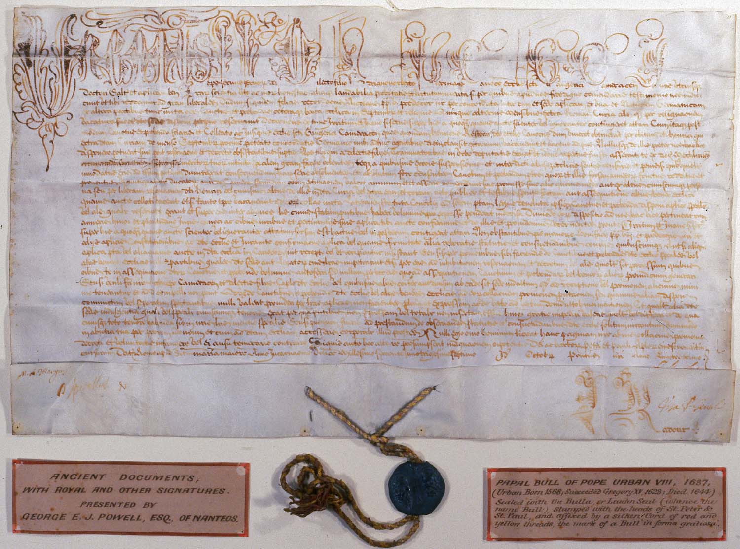
File:Papal.bull.JPG
A Papal Bull of Pope Urban VIII from 1637AD.


Yale's Avalon Project is a great resource, with a host of legal and historical documents listed by century.  You can find it here

Yale Avalon Project

At Fordham University, several historical document sourcebooks have been assembled.  While the particular slant and perspective of these collections is sometimes a bit odd (it is, frankly, difficult to tell that Fordham is Catholic from their site), there are still a number of worthwhile sources here.  Three that I would recommend are:

Ancient Sourcebook

Medieval Sourcebook

Modern Sourcebook

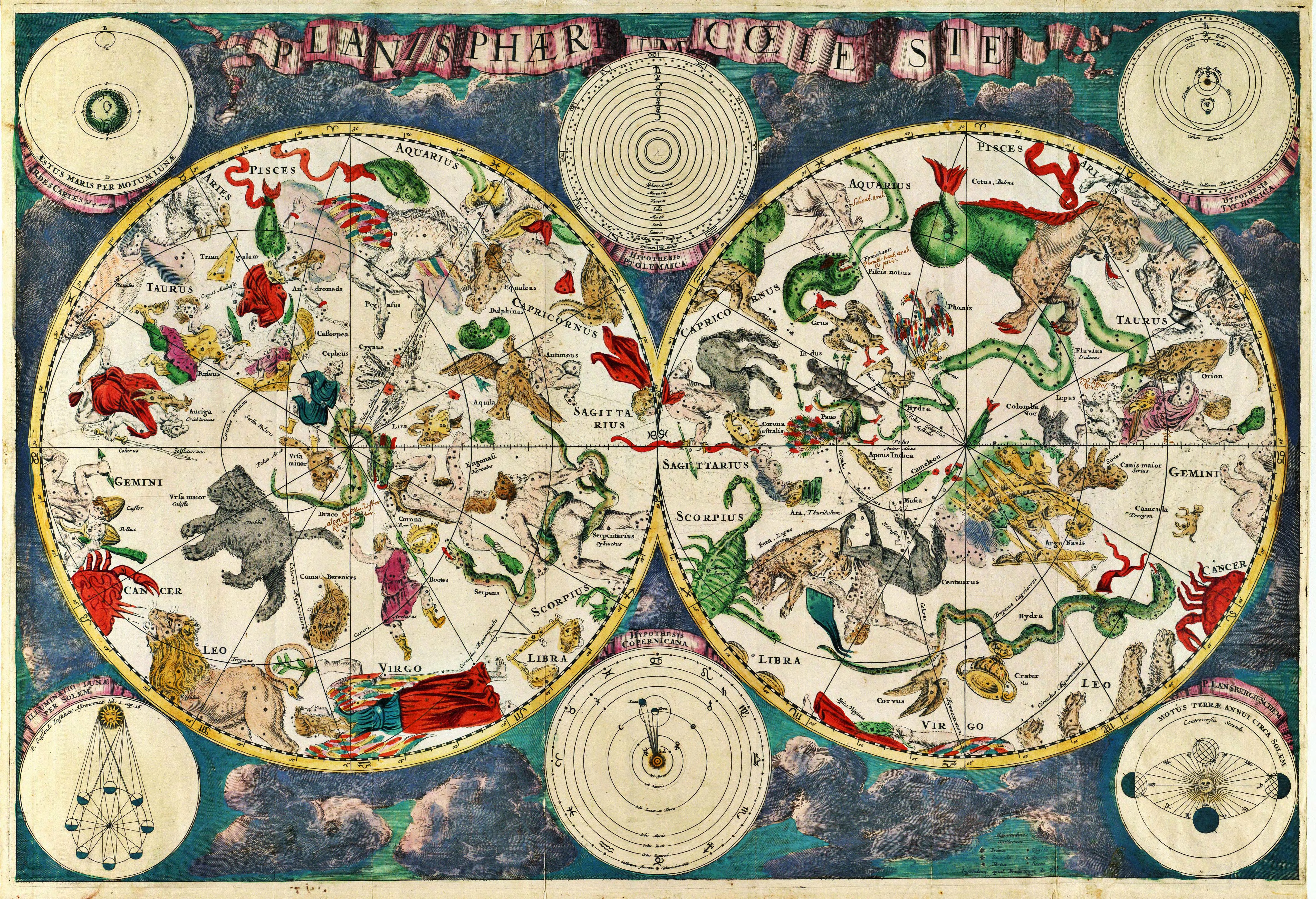
File:Planisphæri cœleste.jpg
Planisphæri cœleste, a 17th Century Map of the Constellations by Frederick de Wit.


This antique map resource is truly splendid, and a real delight to browse through.  This has almost an aesthetic, rather than historical, focus to it.  It is, appropriately named, Old Maps On-line:

Old Maps On-line


The University of Texas at Austin also presents a useful database of historical maps, this at their Perry-Castaneda Library Map Collection:

Perry-Castaneda Library Map Collection

Live well!

Thursday, September 20, 2012

Taxonomy of Non-vascular Plants

Our look at the taxonomical classification of the plant kingdom, begun in the last few weeks, continues today with the simplest members of the that kingdom: the non-vascular plants.

Indeed, aside from the true mosses, only the division (phylum)-level classification of these plants will be presented here.

File:RedMoss.jpg
Image of Moss sending forth its sporophytes -- these plants display the unique alternation-of-generations lifestyle.


Kingdom Plantae

Division Chlorophyta [Green Algae] *


Division Hepaticophyta [Liverworts]


Division Anthocerotophyta  [Hornworts]


Division Bryophyta [Mosses]

  • Class Sphagnopsida [Peat Mosses]
  • Class Andreaeopsida [Granite Mosses]
  • Class Bryopsida [True Mosses] 

*- The Division (Phylum) Chlorophyta [Green Algae] is considered to be a non-vascular plant division here, but a member of the Kingdom Protista by many other sources.


N.B. – The classification of plants is a matter of some debate amongst taxonomists and biologists – you will find variations!  This is the list as presented by the USDA.  Cf., http://plants.usda.gov/classification.html – and the book The Five Kingdoms.


Live well!

Tuesday, September 18, 2012

Cathedral & Oak of Lafayette, LA

Lafayette, Louisiana is today the unofficial capital of the Cajun parishes of the Pelican state.  Once known as Vermilionville, it sits on the Vermilion River just west of the Atchafalaya Basin.

Its important role in the lives of those of Acadiana is, in a unique way, summed up by the song Allons a Lafayette, the first Cajun song to be recorded, which makes mention of going to Lafayette to be married.  This site says a bit more on that subject: http://www.louisianafolklife.org/LT/Articles_Essays/cajun_wed.html

Here is a recording of the song by Lee Benoit:


Sign in front of St. John the Evangelist Cathedral [Photo by author]

In any event, Lafayette, Louisiana is today the seat of the Catholic Diocese of Lafayette, whose neo-Romanesque or Romanesque-revival Cathedral, the Cathedral of St. John the Evangelist, was completed in 1916AD.  It is certainly a striking example of its kind!  It was constructed, as the sign above notes, on ground donated in 1821AD.

 
The interior and exterior of the Cathedral of St. John the Evangelist, Lafayette, Louisiana [Photo by author]

The St. John's Cathedral Oak next to the Cathedral, Lafayette, LA [Photo by author]

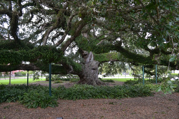
Just next to the Cathedral is a truly magnificent speciman of Live Oak (Quercus virginiana), known as the St. John Cathedral Oak.  This tree, thought to be nearly 500 years old, is a splendid example of what the great oaks of the South can grow to be.  It is 9 feet 2 inches in diameter, 126 feet high, and 134 feet across!

Sign next to the St. John Cathedral Oak, Lafayette, LA [Photo by author]

A view of the trunk and understorey of the St. John Cathedral Oak [Photo by author]

Live well!

Monday, September 17, 2012

150th of the Battle of Antietam

Today is the 150th Anniversary of the Battle of Antietam (Sharpsburg) in Maryland.  17 September 1862 was the bloodiest single day of the American Civil War.

Robert Edward Lee.jpg
CS General Robert E. Lee             US General George B. McClellan

Following the striking victory at the Second Battle of Manassas in late August 1862, Confederate General Robert E. Lee decided to take his Army of Northern Virginia across the Potomac River into the border state of Maryland.  This was done to give Virginia some relief from the ravages of war, put added pressure on the Lincoln administration, and, it was hoped, give an opportunity for Maryland Confederate sympathizers to come out of the woodwork in support of the cause.

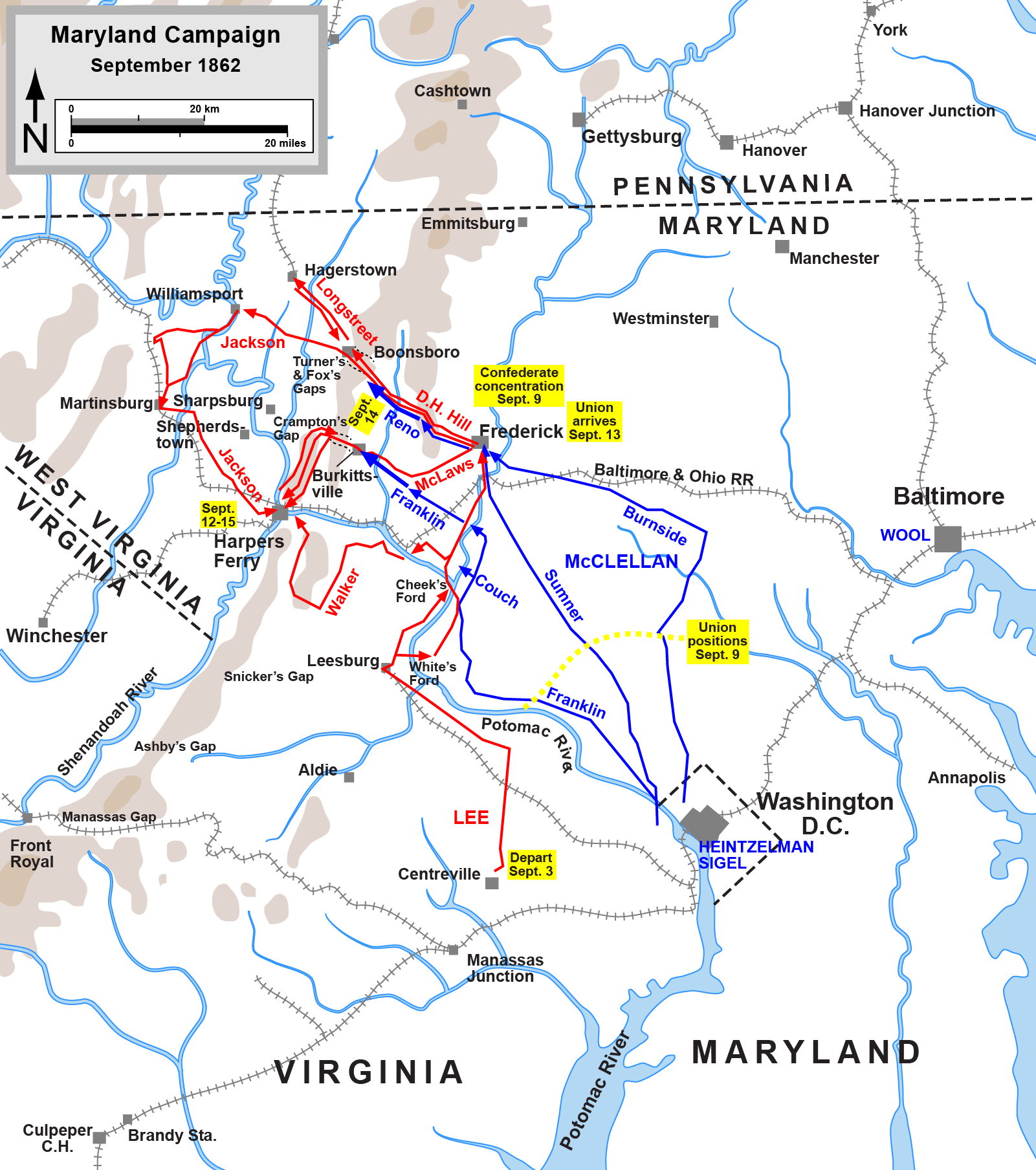
File:Maryland Campaign.png
Overview Map of the Maryland Campaign of September 1862.  [Map by Hal Jespersen, www.cwmaps.com]

Robert E. Lee and his force splashed across the Potomac River from 4-7 September.  A corps of 24,000 under CS General Thomas "Stonewall" Jackson was sent to capture Harpers Ferry with its garrison and armory -- which was accomplished on 15 September 1862.  Jackson captured 73 artillery pieces, 11,000 small arms, 200 wagons, and 12,500 men -- only losing 286 of his own troops in doing so.

Meanwhile, Union General George B McClellan had assumed command of all Union forces around Washington, DC -- not only his own Army of the Potomac, but those remnants of US General John Pope's Army of Virginia, which were now added to the Army of the Potomac.  McClellan went in pursuit of Lee, but with his customary caution and slowness.  It was this lethargy that Lee counted on, as he had divided his much smaller army into several pieces stretching from Harpers Ferry across the Maryland countryside.

On 13 September, Lee's entire campaign plans, Special Order No. 191, fell into the hands of the Union high command -- somehow being left at an abandoned campsite.  Even the cautious US General McClellan saw a chance, and he moved to strike the Confederate Army of Northern Virginia while still spread apart.  The Union Army of the Potomac needed to force its way across a ridge called South Mountain in order to fall upon the divided Southern force.

On 14 September 1862, the Battle of South Mountain unfolded between a couple Union Corps from the Army of the Potomac and a couple Confederate Divisions from the Army of Northern Virginia.  The Confederates held their ground, falling back that night, having bought time enough for Lee to asssemble his army at Sharpsburg, Maryland, along the banks of the Antietam Creek.

Here is the NPS description of the Battle of South Mountain: http://www.cr.nps.gov/hps/abpp/battles/md002.htm

The Battle of Antietam (known as Sharpsburg by many in the South) would be fought on 17 September 1862 between Robert E. Lee's 38,000 man Confederate Army of Northern Virginia, and George McClellan's 75,000 man Union Army of the Potomac.  Lee's force hunkered down along a line stretching from north of Sharpsburg, around the old Dunker Church and Corn Field, southeast to the Bloody Line, and finally along the Antietam Creek itself.  Jackson commanded the left wing, Longstreet the right, as at Second Manassas.  Lee had all of his divisions on the field that morning, save that of CS General A.P. Hill still coming from Harpers Ferry, whose arrival would be critical.

File:Antietam Overview.png
Overview Map of the Battle of Antietam.  [Map by Hal Jespersen, www.cwmaps.com]

The Union Army launched a series of assaults, essentially beginning on the Confederate left flank (near the Dunker Church), and rolling to their right flank, ending at Burnside's Bridge on the Antietam.  From the Union perspective, the attacks came from the right to the left flanks.  The Union Corps attacked in this order through the day: I Corps of Hooker, XII Corps of Mansfield, II Corps of Sumner, and IX Corps of Burnside.

All day long the Confederate host withstood these attacks, sometimes at horrific cost.  When the IX Corps of US General Ambrose Burnside finally forced a crossing of the Antietam Creek, it seemed as though the Union army could finally turn Lee's flank and break the exhausted Confederate host -- but the division of A.P. Hill arrived in the nick of time to stabilize the Army of Northern Virginia.

File:Battle of Antietam.png
A fanciful print of the Battle of Antietam around Burnside Bridge by Kurz and Allison.

The battle on the field would be a stalemate: Lee had held his ground, but barely.  The Union Army of the Potomac lost 12,400 casualties, while the Confederate Army of the Northern Virginia lost 10,300.  Of these numbers from both armies, 3,600 in total were killed.  This was the bloodiest single day of the war.


File:Lincoln and McClellan 1862-10-03.jpg
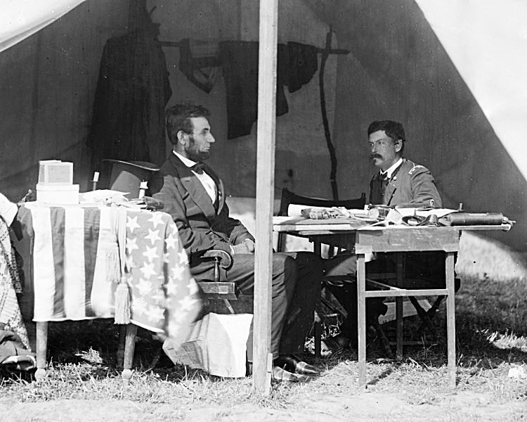
US President Abraham Lincoln meeting with US General George B. McClellan after Antietam.  Two year later, these would be rival Presidential candidates for the GOP (Lincoln) and Democrats (McClellan).

Ultimately, however, Lee would have to withdraw back to Virginia, ending his invasion of Maryland, and paving the way for President Abraham Lincoln to announce his plan to release the Emancipation Proclamation -- freeing those slaves in Confederate, but not Union, held areas.

Here is a link to the NPS account of the Battle of Antietam (Sharpsburg): http://www.cr.nps.gov/hps/abpp/battles/md003.htm

This is a link to the Antietam National Battlefield, well worth a visit: http://www.nps.gov/ancm/index.htm

Live well!

Thursday, September 13, 2012

Atchafalaya River & Basin

The Atchafalaya River of Louisiana -- a name that means long river in Choctaw -- lies at the heart of a massive forested wetland, and is a significant distributary of the Mississippi River.  Its headwaters are flow from the Red and Mississippi Rivers, interestingly enough.

File:Atchafalaya River.png
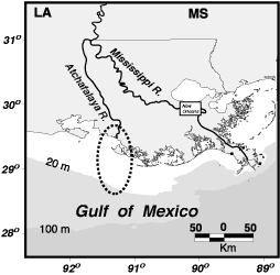
A Map of the Atchafalaya, with the area of its delta in the circle.


Indeed, at its source, the Atchafalaya River actually takes the full volume of the Red River (the same Red River that forms the Texas-Oklahoma state live and upon which Shreveport and Alexandria, Louisiana sit) and 30% of the volume of the Mississippi River.  The flow from the Mississippi River is controled by a series of US Army Corps of Engineer maintained dams and levees in Concordia Parish, Louisiana known as the Old River Control Structure.  It is thought that without the management of the Corps of Engineers, the main channel of the Mississippi would soon shift into the Atchafalaya, leaving Baton Rouge and New Orleans as backwaters!  Here is the website of that facility: US Army Corps of Engineers Old River Control webpage

File:Old River Control Structure Complex.jpg
An aerial view of the Old River Control Structure, with the Mississippi River running to the left (with the riverboats), and three branches, governed by dams, allowing flow over to the Atchafalaya.  The Red River is completely out of view the right discharging its entire volume directly into the Atchafalaya.


Just downstream from this beginning of the Atchafalaya and end of the Red River, there is the famous Morganza spillway, a point on the Mississippi that allows extra volume from that river to be spilled over into the Atchafalaya basin and river.  That spillway has been used twice since its construction: in 1973 and in 2011.  Here is a link to a video of the opening of the Morganza Spillway in May 2011: http://www.cbsnews.com/video/watch/?id=7366074n
 
Diagram of the Water Travel Times down the Morganza Floodway.


The Corps of Engineers have a great video on flood control in this area and the Morganza Spillway: http://www.mvn.usace.army.mil/pao/videos/morganza/morganza.asp

It is soon after the area of the spillway that the river enters the Atchafalaya Basin, a massive forested-swamp that is familiar to anyone who as driven on I-10 between Lafayette and Baton Rouge, LA.  It is currently protected as the Atchafalaya National Heritage Area.  There website can be found here: http://www.atchafalaya.org/


A view of part of the Atchafalaya Basin in Louisiana.

Finally, the Atchafalaya empties into the Gulf of Mexico near Morgan City, Lousiana, presenting a second major delta on the Gulf in the Pelican state.  Like the Mississippi River, the Atchafalaya's sediment plumes can be seen out into the Gulf.

File:Atchafalaya River delta.jpg
Aerial view of the Atchafalaya River delta.

Live well!