Thursday, September 13, 2012

Atchafalaya River & Basin

The Atchafalaya River of Louisiana -- a name that means long river in Choctaw -- lies at the heart of a massive forested wetland, and is a significant distributary of the Mississippi River.  Its headwaters are flow from the Red and Mississippi Rivers, interestingly enough.

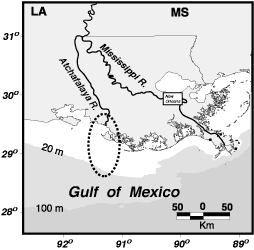
File:Atchafalaya River.png
A Map of the Atchafalaya, with the area of its delta in the circle.


Indeed, at its source, the Atchafalaya River actually takes the full volume of the Red River (the same Red River that forms the Texas-Oklahoma state live and upon which Shreveport and Alexandria, Louisiana sit) and 30% of the volume of the Mississippi River.  The flow from the Mississippi River is controled by a series of US Army Corps of Engineer maintained dams and levees in Concordia Parish, Louisiana known as the Old River Control Structure.  It is thought that without the management of the Corps of Engineers, the main channel of the Mississippi would soon shift into the Atchafalaya, leaving Baton Rouge and New Orleans as backwaters!  Here is the website of that facility: US Army Corps of Engineers Old River Control webpage

File:Old River Control Structure Complex.jpg
An aerial view of the Old River Control Structure, with the Mississippi River running to the left (with the riverboats), and three branches, governed by dams, allowing flow over to the Atchafalaya.  The Red River is completely out of view the right discharging its entire volume directly into the Atchafalaya.


Just downstream from this beginning of the Atchafalaya and end of the Red River, there is the famous Morganza spillway, a point on the Mississippi that allows extra volume from that river to be spilled over into the Atchafalaya basin and river.  That spillway has been used twice since its construction: in 1973 and in 2011.  Here is a link to a video of the opening of the Morganza Spillway in May 2011: http://www.cbsnews.com/video/watch/?id=7366074n
 
Diagram of the Water Travel Times down the Morganza Floodway.


The Corps of Engineers have a great video on flood control in this area and the Morganza Spillway: http://www.mvn.usace.army.mil/pao/videos/morganza/morganza.asp

It is soon after the area of the spillway that the river enters the Atchafalaya Basin, a massive forested-swamp that is familiar to anyone who as driven on I-10 between Lafayette and Baton Rouge, LA.  It is currently protected as the Atchafalaya National Heritage Area.  There website can be found here: http://www.atchafalaya.org/


A view of part of the Atchafalaya Basin in Louisiana.

Finally, the Atchafalaya empties into the Gulf of Mexico near Morgan City, Lousiana, presenting a second major delta on the Gulf in the Pelican state.  Like the Mississippi River, the Atchafalaya's sediment plumes can be seen out into the Gulf.

File:Atchafalaya River delta.jpg
Aerial view of the Atchafalaya River delta.

Live well!

Monday, September 10, 2012

Turkish Cities -- then and now

For students of history, Asia Minor is a gold mine of sites of historical significance.  From Alexander the Great to the Roman Empire, to the era of the Crusades, the great cities of Asia Minor have figured prominently.

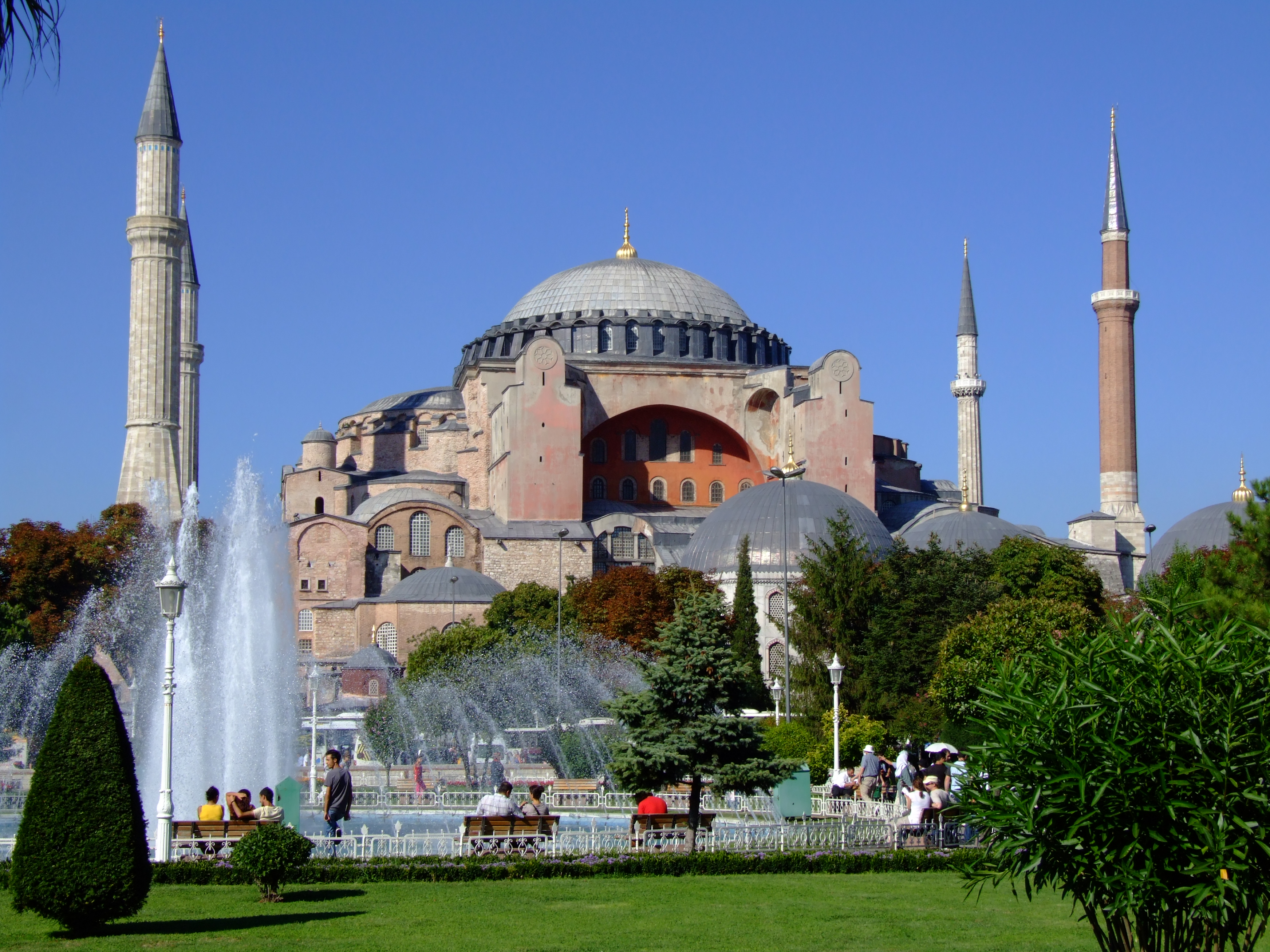
File:Hagia Sophia (5 Aug 2008).jpg
Hagia Sophia in Constantinople -- now Istanbul.

File:Map Byzantine Empire 1025-en.svg
The Byzantine (East Roman) Empire in 1025AD, under Emperor Basil II.


A particular difficulty is that many of the these famous places now go under different names than they did in the Classical or Crusader era.  What I have done here is compile a list of cities -- listing first their old, perhaps more familiar, name in Italics, and then the new, Turkish name, in Bold.  I have also included the briefest of historical notes for each city, to jog the gentle reader's memory.  Enjoy!
  • ConstantinopleIstanbul.  Capital of the Eastern Roman, Byzantine, and Ottoman Empires.  Of course, it was, and still is, the seat of the successor of St. Andrew the Apostle, the Patriarch of Constantinople.


  • AdrianopleEdirne.  Site of the great battle where the Emperor Valens was defeated by Goths in 378AD.


  • NicaeaIznik.  Site of the first Ecumenical Council in 325AD where the Divinity of Christ was defined.  In the 13th century a capital of the Byzantine Empire of Nicaea; this when Constantinople was ruled by a Latin Empire.
 
 
  • NicomediaIzmit.  This city was a Roman capital, and home of Diocletian, before Constantine shifted the seat to Constantinople.


  • SmyrnaIzmir.  Significant Greek port city; St. Polycarp was bishop here.


  • Myra Demre.  This city had the distinction of being the See of St. Nicholas.


  • Alexandretta – Iskenderun.  Founded to commemorate a victory of Alexander the Great and a notable seaport.


  • AntiochAntakya.  Seat of Patriarch.  St. Peter the Apostle was once bishop here, in this city where the followers of Christ were first called Christians.  It was also the center of a significant Crusader state.


  • Angora Ankara.  The modern capital of Turkey was famous for its wool.


  • Iconium Konya.  This city played a role in several Crusades that crossed Anatolia.


  • Dorylaeum Eskisehir.  This was the site of a significant battle of the First Crusade.


  • Caesarea Kayseri.  This was an important road junction and trade center.  St. Basil the Great was bishop here.


  • SebasteiaSivas.  This was the home city of St. Blaise in Eastern Turkey.


  • Edessa Sanliurfa.  There is much that could be said about this city, with its links to the Shroud of Turin, St. Thomas the Apostle, and the Crusader state.

Live well!

Friday, September 7, 2012

St. Louis Cathedral & Jackson Square

Jackson Square, New Orleans, Louisiana [Photo by author]

One of the most picturesque cityscapes in the United States is surely Jackson Square in New Orleans, Louisiana.

Informational sign about New Orleans on the south side of the square. [Photo by author]

Of course, New Orleans, Louisiana was founded in 1718AD by Jean-Baptiste Le Moyne, Sieur de Bienville, who served four different terms as governor.  His brother, the Sieur d'Iberville had earlier founded the city of Biloxi in what is now Mississippi.  The city was strategically located near the mouth of the Mississippi River, and at a portage site from the great river and Lake Pontchartrain to the north.  It would be named New Orleans in honor of Philippe, Duke of Orleans, nephew of Louis XIV and regent of France from 1715-1723 during the early reign of Louis XV.  As the whole colony was named for King Louis XIV, Louisiana, the main parish, and which would become the cathedral, of the new city was named for his patron, King St. Louis IX of France.

A sign noting the historical name for the main square of New Orleans. [Photo by author]


Jackson Square, named for Andrew Jackson in honor of his 1815 victory over the British at the Battle at Chalmette in the War of 1812, was originally known as the Place d'Armes, or, during the Spanish era (1763-1803), Plaza de Armas.  It was here that the city's main parish, and, after 1793, Cathedral, along with its main government building, the Cabildo, are located.

St. Louis Cathedral-Basilica, New Orleans [Photo by author]


The Cathedral-Basilica of St. Louis, King of France, sits on a site used as a Church since 1718 and the founding of the city.  In 1727, a permanent structure was completed, only to burning down in the great fire of 1788.  A new, Spanish-built Church, was completed in 1794.  Later, in 1851, the present structure was completed as it was decided to remodel and enlarge the earlier building.  It remains a distinctive and immediately recognizable structure!

The Cabildo of New Orleans, Louisiana [Photo by author]

Immediately "upstream" or west of the Cathedral was the Cabildo, which was the seat of the Spanish government that ruled "Luisiana" from 1763 until the return of the colony to a short-lived French rule in 1803.  This building saw the official transfer of rule to the United States.

Live well!

Thursday, September 6, 2012

Evangeline & St. Martinville, LA

Evangeline: A Tale of Acadie by Henry Wadsworth Longfellow, published in 1847AD, is surely one of the great epic poems ever produced by an American author.

Evangeline Monument next to St. Martin Church, St. Martinville, Louisiana. [Photo by author]

The story recounts the expulsion of the Acadians from what is now Nova Scotia in Canada, and their eventual settlement in the bayous of Louisiana.  The particular focus, of course, is upon a girl named Evangeline and her personal trials and her tragic relationship with a fellow named Gabriel.  If you have never read the poem, I don't wish to spoil the tale -- and you can read it here: Evangeline: A Tale of Acadie

Map of Louisiana highlighting Saint Martin Parish
Location of St. Martin Parish in Louisiana.  St. Martinville lies in the northern of the two sections.

The end point of this tale is the charming town of St. Martinville, Louisiana in St. Martin Parish.  St. Martinville, first settled in 1765 and incorporated in 1817, is one of the oldest towns in the Cajun area of Louisiana, and sits just south of Lafayette on Bayou Teche.  It would be a center of settlement for the displaced Acadians, who became Cajuns, and later of French exiled from the Revolution or those fleeing the epidemics of New Orleans -- giving the town the nickname of Le Petit Paris.


  Images of the Church of St. Martin in St. Martinville, LA. [Photos by the author]

The town is the home of the oldest parish in Cajun country, St. Martin de Tours Church, which sits on the town square in the center of the village.  This parish Church is known as the Mother Church of the Acadians and boasts a baptismal font donated by King Louis XVI of France.

Image of the Evangline Oak in St. Martinville, LA. [Photo by author]

Of course, the town is also famous for both its monument to Evangeline, pictured above, which sits behind the parish Church of St. Martin, at the burial place of the historical Evangeline.  Also, next to Bayou Teche is the splendid live oak, the Evangeline Oak, made famous by the poem of Longfellow.

Live well!

Tuesday, September 4, 2012

Viceroyalty of New France

New France: This massive French colony included all of the French possessions in North America -- which they ruled from around 1600 until the Treaty of Paris in 1763AD at the end of the French and Indian War (Seven Years' War).  After 1763, France only retained St. Pierre et Miquelon off the coast of Newfoundland, as they do to this day!  Their territories east of the Mississippi went to Great Britain, while those west were granted to Spain.  Let us take a look at the major provinces within New France, then, before its 1763 dissolution:

File:Nouvelle-France map-en.svg
Map of New France (blue) in 1750AD.  Notice that the French claim is anchored by scattered forts and only the occasional town.  This in contrast to British North America.  A larger version is found here: http://upload.wikimedia.org/wikipedia/commons/b/b0/Nouvelle-France_map-en.svg

  • Acadia (1604): The coastal areas called Acadia were settled by the French in this period – 1605 is sometimes quoted for the founding of Port-Royal in what is now Nova Scotia (though they left the area from 1607-1610).  The French had interests in the East Coast for some time, with fishermen coming to the area of the Atlantic Provinces of modern Canada for some years.  While much of mainland Acadia and Newfoundland was ceded to Britain in 1713 by the Treaty of Utrecht, the French held onto Ile Royale (Cape Breton Island) with its fortress of Louisbourg until the mid-18th century.
  • Quebec [Canada] (1608): The first serious attempt at setting up a colony, not just an outpost for the French crown, came with the leadership of Samuel de Champlain, the explorer and founder.  He founded the city of Quebec in 1608 on the St. Lawrence River.  This would remain the capital and center of New France until its fall in the French and Indian War to the English.  The cities of Trois Rivieres (1634) and Montreal (1642) to the west of Quebec would also be important cities and centers, each with their own local governor.  This area was mainly focused on the fur trade.  French Jesuits, did, however, work on the conversion of the locals (Cf., St. Isaac Jogues and St. John de Brebeuf) and French explorations unlocked the Great Lakes and upper Midwest.  Notable was the journey of the Jesuit Marquette and Joliet in 1673 down the Mississippi, as far as Arkansas, coming from Lake Michigan.  A Bishop, the first being Blessed Francis de Laval de Montmorency, was appointed in 1658, and then a diocese was formed at Quebec City in 1674AD.
 
  • Plaisance [Newfoundland] (1655): This was the seat of the governors of the French colony in the island of Newfoundland.  The French would contend with the British over control of the island.  It would be ceded to Great Britain in 1713 with the Treaty of Utrecht.
 
  • Louisiana (1699): La Salle, the French explorer, reached the mouth of the Mississippi in 1682, naming this river basin for the king, Louis XIV: Louisiana.  It would first see settlement under Iberville at Biloxi [MS] in 1699, and, under his brother Bienville, at Mobile [AL] in 1710, and New Orleans in 1718 (which became the capital in 1723).  This gave the French control of the Mississippi, and added to their St. Lawrence and Great Lakes presence: they had a solid claim to the interior of North America with its fur trade.  In 1717, the Illinois country, or "upper Louisiana" was formally "incorporated administratively to the colony of Louisiana." [Chartrand, The Forts of New France, 6]
Organizational Chart for the Governance of New France.  It is a fascinating contrast with that of the English colonies of North America.  You can see a bigger version here: http://upload.wikimedia.org/wikipedia/commons/0/01/Constitution-of-new-france-1759.png

       
  • Governance of New France: The French had a practice of sparse settlement (there were but 3,215 French in 1666), with scattered forts for trading and Jesuit missionary work with the Indians.  The entire viceroyalty was ruled by a Governor-General (responsible for Defense [Marines], Trade, Industry, and Roads) who was resident at Quebec [pop. in 1666, 547], along with an Intendant (who was responsible for Public Works, Finances, and Courts), a Bishop, and a Supreme Council (presided over by the Intendant, and serving as Supreme Court of the Viceroyalty), while local governors managed affairs and local militias in Trois Rivieres [pop. in 1666, 455], Montreal [pop. in 1666, 625], Acadia [later just Ile Royale], Louisiana, and Plaisance [Newfoundland].
You can read more about the office of Intendant here: The Office of Intendant in New France by Munro

A few sources that I found most useful for this: American Colonial and Revolutionary History by Smelser, Colonial American Troops by Chartrand; and Forts of New France by Chartrand.

Live well!

Monday, September 3, 2012

Taxonomy of Non-Seed Vascular Plants

Today's post will take a look at the general taxonomy of another group of plants in the vascular plant subkingdom -- the non-seed vascular plants.  The seed plants, the angiosperms and gymnosperms, having already been covered earlier, it is high time we move to the non-seed plants!  These plants reproduce through alternation of generations and make use of spores, rather than the seeds that we might usually associate with plants.

The most famous group of non-seed vascular plants, by far, is that of the Ferns.  Certainly, too, many folks are rather familiar with Horsetails, as well.

File:Equisetum x moorei3.JPGFile:Ferns at melb botanical gardens.jpgFile:Lycopodium dendroideum.JPG
From left to right: Horsetails, Ferns, and Ground Pine (a type of Club-Moss or Lycopod)

So, without further ado, here is an overview of the non-seed vascular plants, and please know that this is not an exhaustive list:
----

Kingdom Plantae
Subkingdom Tracheobionta [Vascular Plants]

Division Equisetophyta [Horsetails]
·         Class Equisetopsida or Sphenopsida
o   Order Equisetales
§  Family Equisetaceae [Horsetail family]

Division Lycopodiophyta [Lycopods]
·         Class Lycopodiopsida
o   Order Isoetales
§  Family Isoetaceae [Quillwort family]
o   Order Lycopodiales
§  Family Lycopodiaceae [Club-moss family]
o   Order Selaginellales
§  Family Selaginellaceae [Spike-moss family]


Division Psilophyta [Whisk-ferns]
·         Class Psilopsida
o   Order Psilotales
§  Family Psilotaceae [Whisk-fern family]
 

Division Pteridophyta [Ferns]
·         Class Filicopsida
o   Order Hydropteridales [Water Ferns, 3 families]
o   Order Marattiales
§  Family Marattiaceae [Vessel Fern family]
o   Order Ophioglossales
§  Family Ophioglossaceae [Adder’s-tongue family]
o   Order Polypodiales
§  Family Aspleniaceae [Spleenwort family]
§  Family Cyatheaceae [Tree Fern family]
§  Family Dennstaedtiaceae [Bracken Fern family]
§  Family Dryopteridaceae [Wood Fern family]
§  Family Hymenophyllaceae [Filmy Fern family]
§  Family Osmundaceae [Royal Fern family]
§  Family Polypodiaceae [Polypody family]
§  Family Pteridaceae [Maidenhair Fern family]
§  Family Schizaeaceae [Curly-grass family]
§  Family Thelypteridaceae [Marsh Fern family]

Nota bene: taxonomy is always a matter of debate and discussion – you may find different arrangements than those listed here.

Source: United States Department of Agriculture: http://plants.usda.gov/classification.html
----

Live well!

Saturday, September 1, 2012

150th of the Battle of Chantilly (Ox Hill)

Today I continue the day-by-day look at the events of 150 years ago in Northern Virginia.

Confederate General Robert E. Lee, having defeated the Union Army of Virginia, commanded by US General John Pope at Second Manassas, now sought to cut off its retreat to Washington, DC.

Despite the significant victory at Manassas, the Union army did manage to retreat to the high ground of Centreville, where the army rested on 31 August, the day after the battle ended.

Lee thought that it might be possible for Stonewall Jackson and his hard marching Confederate Corps might be able to march to the north and then to the east and cut off the Union army at Centreville.

Sequel to Second Manassas Panel
This sign at Chantilly (Ox Hill) Battlefield shows the flanking route of Stonewall Jackson.  Click here for a larger version of the map, and infomation on its location: http://www.hmdb.org/Marker.asp?Marker=15618

The weather did not favor the Southern cause.  Rain slowed the progress of Jackson and his exhausted troops.  Jackson had to march due north from the battlefield to the point of modern highway US50, then turn east marching to West Ox Road.  Pope and his Union troops only had to march down what is now US29 to the same junction -- the difference between 5 miles and 18 miles.

The Battle of Ox Hill Marker
This is the Civil War Trails sign for the Battle of Chantilly (Ox Hill).  The full text, and location of the sign can be found here: http://www.hmdb.org/Marker.asp?Marker=116

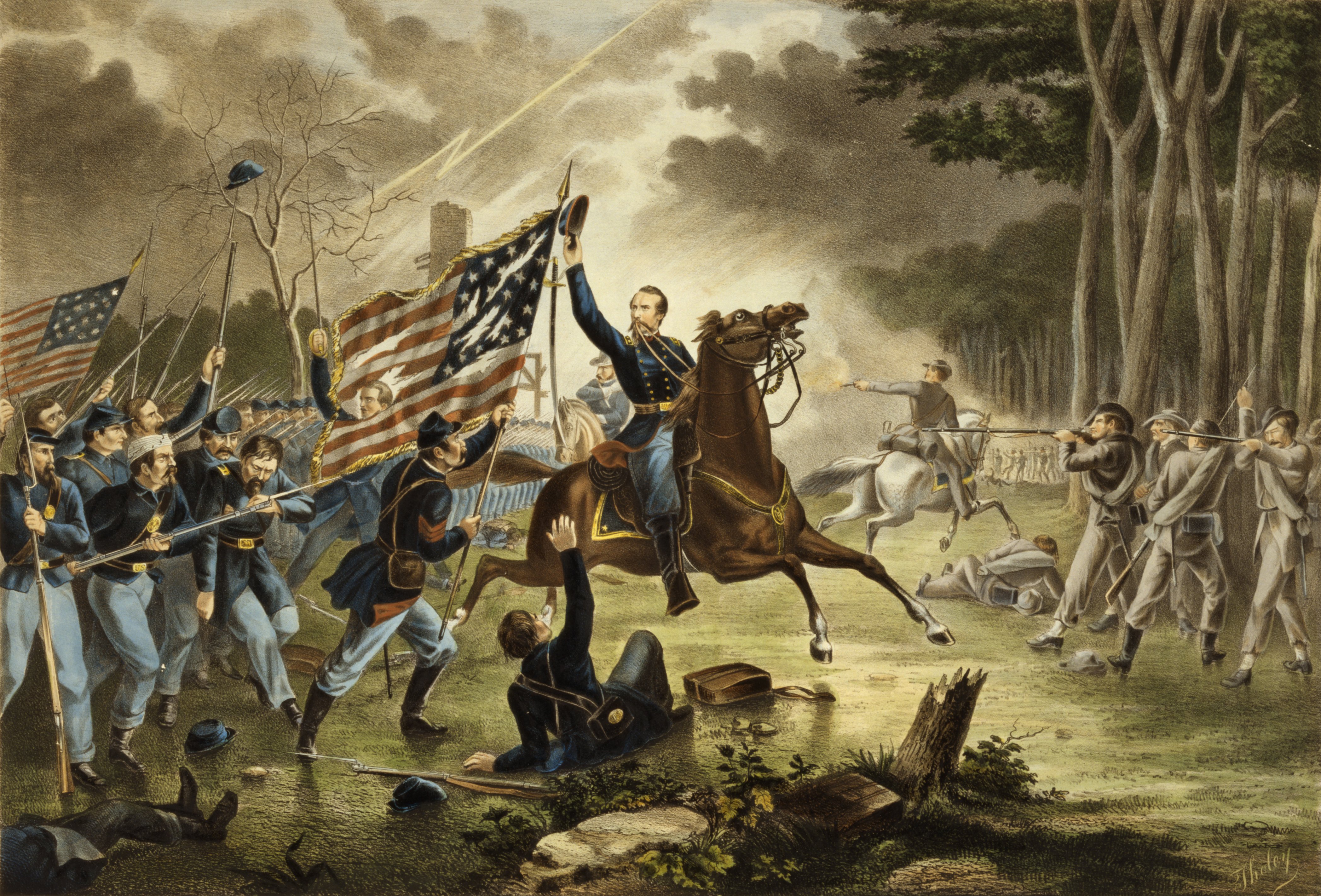
On 1 September 1862, the two sides clashed at the Battle of Chantilly (Ox Hill), where two Union divisions, that of US General Philip Kearny and General Isaac Stevens, blocked Stonewall Jackson's Corps.  Despite the casualities of Second Manassas, no General died on that field of battle -- but at Chantilly, both Kearny and Stevens lost their lives.

File:Kearny's Charge, Battle of Chantilly.jpg
General Kearny's Gallant Charge by Tholey, ca. 1867

In the end, however, the battle meant that Stonewall Jackson was too late, and the defeated Union army would be able to withdraw to the defenses of Washington, DC.

Here is the NPS account of the battle: http://www.nps.gov/history/hps/abpp/battles/va027.htm

There US General John Pope would be relieved of command, with US General George B. McClellan, of the Union Army of the Potomac taking charge of all Union forces in the region.

Confederate General Robert E. Lee, however, was ready to move his force north of the Potomac for the first invasion into Maryland...

Fairfax County, Virginia, has actually preserved the core area of the battlefield in a county park: http://www.fairfaxcounty.gov/parks/oxhill/

Live well!